
Issue Overview
BDU (Boulder Municipal Airport) has become a growing contributor to noise, lead, and air pollution. According to AirNav.com, the FAA recorded an average of 155 flights per day in 2017. This has increased drastically since then with the expansion and growth of RMMA located a few miles to the south, the expansion of Vance-Brand airport to the north and the expansion and growth of Boulder's own businesses based at BDU.
"But the airport was here first!"
Boulder was here first and the airport was built too close to the city. With a wall of mountains to the west, growth can only go towards the airport. There is no buffering land between homes and businesses and the airport property. This was not an issue until recently, when what appears to be explosive flight school and touring growth based at BDU increasing noise and air pollution to most of East and Northeast Boulder City and County. "Don't move near an airport if you don't want to hear the planes".
Recently the City of Boulder spent millions on updating the train track intersections so the conductors wouldn’t have to blast their horn. The trains come through maybe 3-5 times a day/night. The horns lasted a couple of minutes. No one scolded folks about moving near a |
train track. The community simply moved forward with a means to create a quieter environment. Boulder spent millions on this noise mitigation that was far less of a burden, pollutant, hazard and risk than what the airport is impressing on the community.
City council also spent a considerable amount of time and bandwidth ensuring CU Boulder party noise and parking could be best regulated for the folks in the Chautauqua area. At no point did anyone apply the "if you didn't want to hear party noise don't move near a college" dynamic. “Boulder Airport is needed during emergencies” BDU does not contribute to emergency support operations beyond helicopters. Slurry bombers and the like are unable to use BDU because the runway cannot accommodate them.
The city has multiple response recovery resources and the existence of an airport does not reflect the emergency preparedness of a community. Any flight resiliency is in a heliport and not an airport for City of Boulder. A heliport only needs approx 10 acres and this retention and evaluation for need is in discussion for decommissioning the airport. BDU now impacts the area in the following ways:
“But Boulder cares about the environment and climate!"BDU fundamentally conflicts with Boulders notorious “green” image. As City staff regularly discuss climate impacts, the hundreds of circling leaded gas GA planes need to enter the conversation.
|
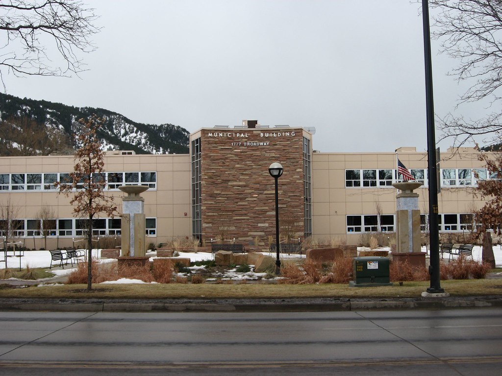
Boulder Airport's Dangerous Location |
|
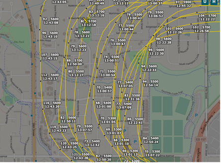
The above issues are here, and only getting worse as more people build in the City and County of Boulder. With the airport’s proximity to city center, landing and takeoff patterns are fundamentally dangerous. At best, if pilots are skilled and thoughtful, planes takeoff or land 300-600 feet above homes and businesses at times over 50 times a day.
This image captures one moment in time of a single airplane training “circuits” AKA “touch-and-goes” over North Boulder. This area is densely and fully populated with apartments, businesses, and trails. For reference, 28th Street is a major artery to enter and exit Boulder and is better known as highway 36 on regional maps. This entire area is located at around 5200’ in elevation, with planes flying 300-600 feet above their rooftops. |
|
Boulder City and Airport Noise Abatement Procedures are Increasingly Disregarded
|
The most prolific growth lands squarely on one BDU business providing touring, renting, and training, as well as FBO and the sale of leaded gas. There are a few other businesses based out of BDU and the list can be found in this public link. Touring and training planes out of BDU fly extensively over Boulder city and county as early as 6:30 AM until 9PM, disregarding the airport and city official noise abatement that requests no touch and goes before 8AM and after 5PM.
BDU pilots and visiting pilots violate or regularly barely meet FAA minimum flight elevation laws. Seen closer on another occasion captured from PublicVue website, is an example of touring planes flying under 900’ (under the federal requirement of 1,000’ or more over congested areas) over Boulder hotels, the post office, Boulder Humane Society, restaurants, trails, homes and more. 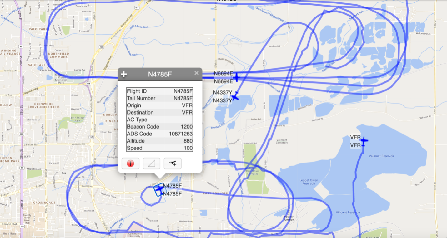
|
More often than not pilots increasingly train or tour over delegated noise sensitive areas. They also do so below the 7500’ elevation request, and often below the 1000' federal minimum for flights over densely populated areas.
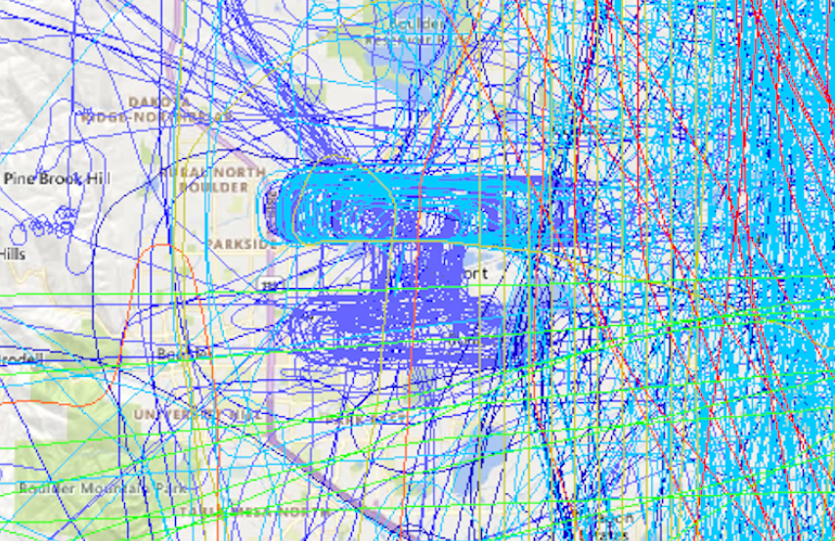
In this above image example, Boulder tour planes represent most of the purple flight patterns seen in this heatmap so thick you cannot see area names on the map. These display just one day (June 3rd, 2021) of Boulder-based planes over Boulder. The light blue lines are flights originating from Rocky Mountain Metropolitan Airport that use BDU for touch-and-goes and other flight training. The red and green lines represent departures and arrivals at Denver International Airport.
|